| Search results - "Top-End" |
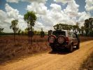
D3 in Litchfield National Park, on another part of the Reynolds Track51 viewsAnother shot of the flood plains and the magnetic trmite mounds.
|
|
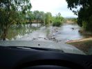
D3 in the Mary River Flood plains47 viewsIn this part of the world, on the flood plains out to Kakadu, you never get out to wade a creek first as the theory says you should. If the water isn\'t clear, like it was on this causeway, and it is this wide, you either wait for someone else who is braver than you to cross first, or you turn around and go home. These rivers are full of estuarine (salt-water) crocodiles, and they are starting to reach 7 metres in size in some still rare instances. However, seeing as a 2.5m crocodile can kill a grown man,
|
|
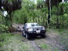
D3 in the Mary River Flood plains50 viewsFamily was down South with the In-laws, so I went for a drive on Boxing Day - which is the monsoon time, or \'The Wet\'. Was doing a test run with the off-raod trailer in preparation for the trip I was planning to the Kimberley six months later. Couldn\'t quite make it out of the creek, so a self-recovery was in order. Good thing it all worked, as I didn\'t see another car in over four hours. They were too smart to drive down the track I was on!
|
|
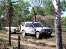
D3 in Kakadu National Park, on the track into the Alligator Billabong47 viewsThis whle area is down on the flood-plain, so in the Wet it is all under a few inches of water. In the dry it has a hard but brittle surface, which is then chewed up in many places by the feral animals with hard hoofs such as buffalo, pigs and horses. This then turns the track into a big dust bowl which is primarily bull-dust - a soft fine powder like talcum powder, which can be many feet deep, and gets into everything. The cover on the trailer is actually black.
|
|
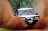
D3 on the Gold-fields Loop South of Darwin, and North of Pine Creek. 68 viewsThis is the middle of January, so is right in the middle of the Wet. Red mud. EPB hates it.
|
|
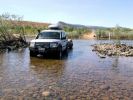
D3 in the Kimberley - on the Gibb River Road, crossing the Pentecost River49 viewsNot too far in on the Western end of the Gibb River Road is the Pentecost River, with the ranges in the back ground - an iconic shot of the Gibb River Road.
|
|
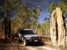
D3 in Kakadu National Park, on the track into Graveside Gorge51 viewsKakadu National Park is in a World Heritage area, with the entrance about 3 hours out of Darwin. It took another hour to get to the un-marked track into Graveside Gorge, which then took three hours to travel the 41km in. Not a tough track, but a series of big wash-outs with very deep and soft sand in the creek beds made driving fun. The most amazing thing, was that we had the whole place to ourselves. No marked tracks, so bushwalking involved blazing a trail using GPS and topo maps to find the way.
|
|
D3 in Litchfield National Park, on the Reynolds Track44 viewsThis track takes you through the bottom half og the Litcfield National Park, and because the track has some deep creek crossings it keeps the numbers down, seeing as it is only 90 minutes out of Darwin. It is a flood plain between two long ranges and has numerous \'Magnetic termite\' Mounds.
|
|
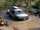
D3 in the Kimberley - on the track to the Mitchell Falls, crossing the King Edward River49 viewsSix weeks after the tharck has been opened the water levels in the King Edward River have greatly reduced. This is the start of the 80km track up onto the Mitchell Plateau.
|
|
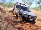
D3 in the Kimberley - on the track to Port Warrender45 viewsBeyond the track to the Mitchell Falls is the very rough track down to the coast and Port Warrender
|
|
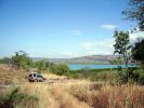
D3 in the Kimberley - at Port Warrender44 viewsAfter taking 90 minutes to travel the last 6 km, we arrived at Port Warrender, part of the pristine wilderness known as the Kimberley Coast. The only people down here are mad scientists looking for spiders and rocks - and mad keen 4WD\'ers.
|
|
|
|
|